Luotuoling Fm
Type Locality and Naming
The Luotuoling Fm was named by Xing Yusheng in 1982. The typical section is situated in Luotuoliang to Laoguading section of the Qingbaikouan System, north of Jixian City in Tianjin Municipality.
Synonym: (骆驼岭组)
Lithology and Thickness
The Luotuoling Fm is dominantly composed of pebbly arkose, quartzose sandstone, glauconitic sandstone and variegated shale, and subdivided into two lithologic members. The basal part of the First member is pebbly sandstone and conglomerate, with the pebbles generally bearing limonite coatings and poorly sorted, and cemented by ferruginous or argillaceous matter. The Second member is dominated by variegated shale, bearing flat and wavy beddings, and the basal part is shale intercalated with lenses of glauconitic sandstone and arkose. The sandstone in this formation bears large bidirectional cross-beddings, flat-beddings or wavy beddings and has fining-upward features. The formation has a thickness of 118 m. [See Depositional setting for facies interpretation.]
Relationships and Distribution
Lower contact
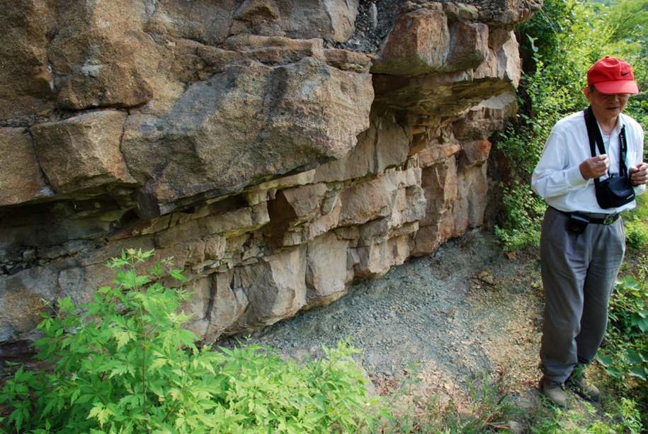
The lowermost part is yellowish gray coarse-grained pebbly quartzose sandstone, which rests disconformably on the underlying Xiamaling Fm (see figure). But in Tangshan, Luanxian and Laiyuan area of the basin periphery, it can overlap onto the older strata (Wumishan Fm, Puyu Fm).
[Figure: The boundary between the Luotuoling Formation and the underlying Xiamaling Formation]
Upper contact
The upper part is greenish gray shale or siltstone, which disconformably overlain by the Jing'eryu Fm.
Regional extent
The Luotuoling Formation is widely distributed in Zhuolu, Yuxian, Laiyuan, Luanxian, Yixian, Xinglong, Jixian counties and also in Kuancheng and Renqiu counties.
GeoJSON
Fossils
Besides the fossils of Chuaria circularis, the shale in Longfengshan of Huailai County was discovered to yield Vendotenia sp., Shouhsiennia shouhsienensis, Longfengshania sp. etc. and microplants Orygmatosphaeridium sp. etc.
Age
Depositional setting
The lower member is interpreted as a river facies derived from a low-water system tract (LST). The upper member is interpreted as a transgressive system tract (TST). Sedimentary structures in the sandstones are interpreted as littoral sandbank to lagoon facies.
Additional Information
The K-Ar ages on glauconite include 855 Ma, 870 Ma and 890 Ma.
